The HMS Association with three other ships were wrecked on the Isles of Scilly in 1707 with huge loss of life. MAT volunteer Roger Burns discusses how this tragic event kicked started a desire to determine how longitude could be measured at sea, leading to a significant monetary reward culminating in a successful claim by a carpenter for his invention, the marine chronometer. This was a very significant advance in global maritime navigation resulting in chronometers being installed on ships, a number of which have been recovered from wrecks and are on display at the Shipwreck Centre and Maritime Museum.
The loss of HMS Association and three other ships in 1707
HMS Association, a wooden-hulled 50.29m long 90-gun 2nd Rate Ship of the Line, commanded by Sir Cloudesly Shovel was wrecked on 22 October 1707 on the Scillies due to a navigational error (Figure 1). It was en route to Portsmouth from Toulon and Gibraltar with a fleet of other ships, three of which, HMS Eagle, HMS Romney, and HMS Firebrand, also went aground there, with an overall loss of life of over 2,000. An account of the disaster can be read here and the wreck site is now designated a historic wreck under the Protection of Wrecks Act 1973 due to its archaeological significance.
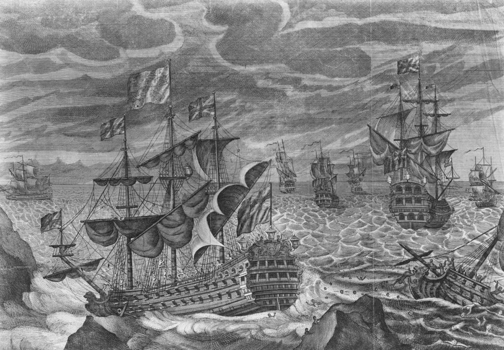
Figure 1: HMS Association with the Eagle, Rumney & Firebrand on the rocks of Scilly.
Source: Unknown author, Public Domain, via Wikimedia Commons
.jpg)
Measuring Longitude at Sea
Mariners had long been able to assess latitude using instrument readings of celestial objects, but could not establish longitude with accuracy at sea. Early sailors were well aware of the principle of calculating longitude – that for every 15 degrees travelled eastward, the local time moves forward one hour. Similarly, it was understood that time moves back one hour for every 15 degrees travelled west. Ships at that time carried pendulum clocks which were fundamentally and significantly inaccurate at sea due to the ships motion impacting the pendulum. Although time was measurable by observing the sun’s position, it was necessary to couple that for reference with the time at a fixed location, impossible on the open ocean.
Although not directly responsible, the wreck of the Association and the other vessels contributed to establishment in 1714 of the Board of Longitude which offered £20,000 (approx. £4.1m in 2021) for a final and accurate method of calculating longitude. There was a huge response, including from Europe, but it was John Harrison, a carpenter by trade and amateur wooden clockmaker from Barton-on-Humber, who won the prize in 1772. Starting in 1727, he completed his prize-winning instrument in 1759 having received 25% as payment on account in 1763 as noted below. The Board was disbanded in 1826 by Act of Parliament.
An extract from the Caledonian Mercury of 21 March 1763, Figure 2, follows (£5,000 is approx. £1.05m in 2021).:
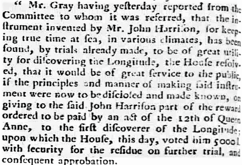
Figure 2: Extract from the Caledonian Mercury 21.03.1763
Source: British Newspaper Archive – Public Domain
Subsequently, the trials were successful. The challenge of accurate measurement of longitude can be appreciated by the elapsed time between the prize being offered in 1714 and the successful trials by Harrison in 1763. The original contraption designed and built by Harrison can be seen in a video here and here. It was later refined for temperature compensation and reduced in size, by comparison, into a compact marine chronometer. Another video, here, shows the craftsmanship of a John Poole chronometer’s mechanism.
A much more comprehensive account of the Board of Longitude may be read here and of chronometers here.
Examples of Marine Chronometers
Despite the navigational advances, sailing vessels and steamships continued to be lost, often due to adverse weather including fog. Subsequent salvage and investigation have resulted in a range of these being recovered from wrecks. Two such examples are on display at the Isle of Wight Shipwreck Centre and Maritime Museum. Both marine chronometers are brass. The first, Figure 3, was recovered from the Schiehallion.
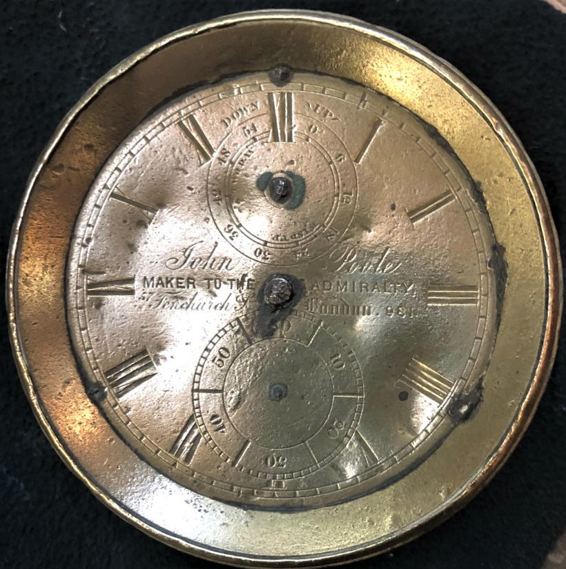
Figure 3: Marine Chronometer from SV Schiehallion wreck. Approx. 11.5cm diameter
It is not known who sailing onboard Schiehallion owned the marine chronometer, but an expert from the Antiquarian Horological Society has kindly confirmed that it was a standard 2-day example dating to circa 1844. Figure 3 shows that it was made by John Poole trading from 57 Fenchurch Street, London and numbered 981. Read here for an account of a John Poole chronometer made some two years later.
The SV Schiehallion was a moderately sized iron-hulled barque launched on 2 December 1869 in Dundee for the UK/New Zealand trade. For its final voyage, the Schiehallion departed Auckland on 21 September 1878 for London but went aground near Blackgang Chine on the Isle of Wight on 13 January 1879. The full history, and why the subsequent Board of Trade enquiry deemed the captain to be at fault can be read here, including a mysterious artefact recovered from the wreck. It should be noted that in Schiehallion’s case, lack of attention to overall navigational aspects was found wanting, rather than deficiencies in longitude evaluation.
The second brass marine chronometer, Figure 4, was recovered from an unnamed wreck sunk off Brook, Isle of Wight. It is in poor condition but appears to have been made by Graham & Parker (or Parkes), 8 Wapping, Liverpool, and probably in the 1870s or even the 1880s. The model number is unclear but may be 52xx.
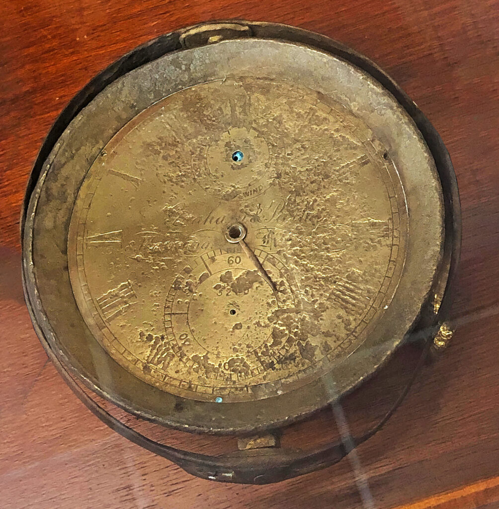
Figure 4: Marine Chronometer recovered from an unnamed wreck off Brook Point
Time Balls
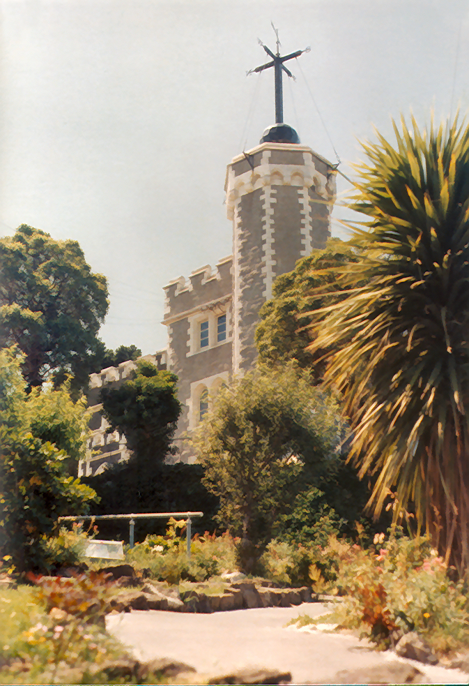
Complementary to the chronometer was the need for ships to regulate their chronometers accurately at port before departing to sea. Measurement of longitude required accurate timekeeping; Time Balls were introduced for this (described here), the Time Ball would give the local time at the moment the Ball began to drop, usually at 12.00 or 13.00 as there was variance at different ports, thus providing the means of accurately resetting the chronometer if required at a point of known longitude. Although Time Balls have been surpassed by electronic and satellite aids, they have been preserved worldwide as tourist attractions, including at Greenwich, Figure 5, and at Port Lyttelton, Figure 6, where the Schiehallion had called.
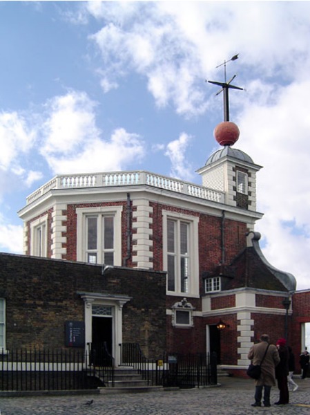
Figure 5: Royal Observatory, Greenwich with Time Ball
Source – Wikimedia Commons. CC BY-SA 3.0