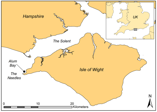
Alum Bay is located on the north coast at the extreme west of the Isle of Wight (see map). Needles Point and surrounding rocks mark the western end of Alum Bay, while the eastern end is defined by Hatherwood Point. In between, the coastline is formed from high chalk cliffs that describe a steady curve. To the northwest is the Needles Channel, where tidal currents can reach four knots. Beyond this lies the edge of the ‘Shingles’ gravel bank, which, like the Needles, is a notorious hazard for shipping.
The geography surrounding Alum Bay has contributed greatly to its maritime archaeological interest. The bay forms the first area sheltered from south westerly winds once past the Needles and en-route to the western Solent. Many vessels have ‘fallen prey’ to the Needles, the submerged chalk ridges nearby, or to the Shingles bank. Sections of these vessels and their artefacts have floated away from the wrecking site to sink in the nearest area of quiet water, often carried there by the tidal eddies and counter streams that flow along the Alum Bay shore. This wrecking process has contributed to the submerged heritage to be found in Alum Bay.
Historical Ship Losses
Historically, there has been a busy nature to the waters around Alum Bay and the Needles, which lead to the western Solent and onwards to the ports of Southampton and Portsmouth. Passage past the Needles and through Hurst Channel offered a tempting, yet risky, short-cut for ships sailing to the Solent from the west. The earliest evidence for shipwrecks comes from the Roman period, in the form of a coin scatter at the Needles which probably came from a wrecked sailing vessel. Historical accounts record the loss of vessels throughout the medieval period and there is a dramatic increase in the records of lost vessels from the 17th century onwards. From this period historical records are increasingly well preserved and publications such as the Lloyd’s List ensured a standard approach to record keeping.
Vessels lost in the area of Alum Bay and the Needles include a fleet of Dutch East Indiamen, numerous merchant ships, small local vessels and Royal Navy warships. One of the latter vessels was HMS Pomone, wrecked on the Needles in 1811, a section of which has settled in Alum Bay and has been subject to detailed recording and publication.
Archaeological Discoveries
The earliest discovery of the archaeological sites in Alum Bay is unclear, but it seems likely that sites have been known about by local divers for many years. The site known to be part of HMS Pomone, previously referred to as ‘Alum Bay I’ was brought to the attention of archaeologists in 1991 and work has been conducted on the site at periodic intervals ever since with concerted work done by the MAT since 1998. The site of Alum Bay 2 was first discovered in 2001 and initial work on this set of shipwreck remains took place between 2001 and 2003, with further survey, sampling or monitoring of the site 2009 – 2013 and periodic monitoring since. In addition to the two pieces of shipwreck, archaeological investigation of Alum Bay has also entailed conducting searches of the bay by divers and with side scan sonar. This work has uncovered a range of material, including a gun carriage wheel, stone cannon shot and the tangled iron remains of Alum Bay’s Victorian pier.
As with many MAT projects, a wide range of people have been involved with this fieldwork, both above and below the water. This has included local divers and dive clubs, students and volunteers, many of whom have taken part in the NAS training scheme and helped in setting up and testing a dive trail that ran 2005 – 2007. Unfortunately the trail proved difficult to keep operational and is no longer active, however, you can click here for a short video showing the site and the trail. Or, you can read about the process of setting up and running the trail in the Needles and Alum Bay Dive Trail Project Report.
.
Searching the Bay
Over the years many divers have told the MAT about pieces of wreck or artefacts that they have seen on dives in Alum Bay, but few of these sightings have any positional accuracy. The potential importance of such reports were reinforced during the Receiver of Wreck’s 2001 Wreck Amnesty, when several finds from Alum Bay were reported. Knowing that there are several more wrecks in the bay prompted more widespread directed searches during MAT work within Alum Bay. Several areas and features were targeted, using a variety of search methods with positions being fixed using GPS.
The eastern edge of the bay came under close scrutiny as the remains of what is known as the ‘Tool Wreck’ were searched for, without success. It seems likely that the remains of this vessel, which was wrecked during the mid-20th century have now been covered by sand.
There is a submerged reef running along the length of the bay, behind which the section of HMS Pomone and Alum Bay 2 nestle. Pinnacles of this reef that are charted come close to the surface, these have been targeted for spot searches. To do this, shot-lines were dropped and their positions marked with a GPS. Following this, circular or pendulum searches were carried out and areas or objects of interest were recorded by divers.
Not surprisingly the western end of Alum Bay, closest to the Needles, has proved more productive for finding evidence of ships, their fittings and artefacts. It appears that larger buoyant sections of shipwreck tend to float further into the inner bay, leaving smaller pieces and artefacts scattered closer to the Needles. Volunteer divers on board local dive boat Wight Spirit skippered by Dave Wendes have continued searches in this area of the bay. Searchers at the western end of Alum Bay discovered a wooden wheel from a cannon carriage, known as a ‘truck’ which was made from an exotic hardwood.
Alum Bay: Publication
MAT were able to undertake further site recording and specialist analysis of the sites in the bay due to generous funding from a number of sources including English Heritage and the Marc Fitch Fund. This brought together the results of eighteen years of fieldwork within Alum Bay. It involved an archive audit, analysis including dendrochronology and metallurgy, alongside historical analysis of the shipwreck remains of both Alum Bay 1 and 2, as well as investigation into environmental factors that impact upon them. It also studied the wider context of maritime activity within Alum Bay to allow the broadest possible interpretation of the maritime archaeological remains.
This work resulted in the publication which formed Volume No. 2 in the MAT Monograph Series, published through Archaeopress in the British Archaeological Reports series.
A management report on all of the archaeological sites situated within Alum Bay was also produced and is available for download here.