The Chesil Beach Cannon Site is a Protected Wreck site represented by two clusters of cannons that date from between 1600 – 1780, which lie 200 metres apart off this dramatic stretch of the Dorset coast. While the assemblages may be related, they are currently thought to represent the remains of two different shipwrecks though their identities have not yet been established. The sites lie between 12 – 15 metres depth.
Explore the Interactive Tour
We’re delighted to present the Chesil Cannon Site interactive tour, developed entirely by our own team from survey to publication, including, modelling and coding of the interactive, with a 3D experience powered by Sketchfab.
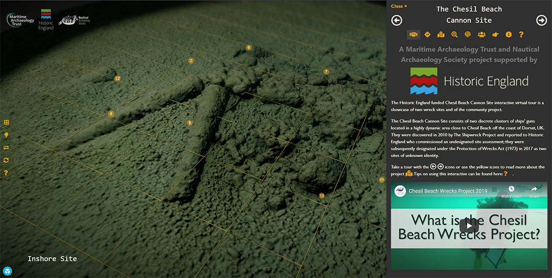
The Inshore Site
The Inshore Site lies at the toe of the beach and includes nine English cannons of different sizes cast between 1650 – 1725 and which could have been part of a ship’s cargo. There are also cannon fragments, concreted iron shot and wooden fragments, which are thought to be the remains of a merchant ship. There is evidence of destructive salvage of this site in recent decades, but it is likely that much remains preserved beneath the heavy concretions.
The Offshore Site
The Offshore Site lies 200m to the south of Inshore site. It is represented by eight concreted cast iron cannons that are likely English, one of which was cast in the second half of the 17th century. These guns are thought to be part of a ship’s armament which may have been jettisoned from a stricken vessel, or which could represent the sinking of another vessel. Generally, the guns appear to be lighter calibre than those of the Inshore Site, though targeted excavation will be required to learn more about their features and origin.
COLLABORATIVE PROJECT – TRAINING, RECORDING AND DISSEMINATION
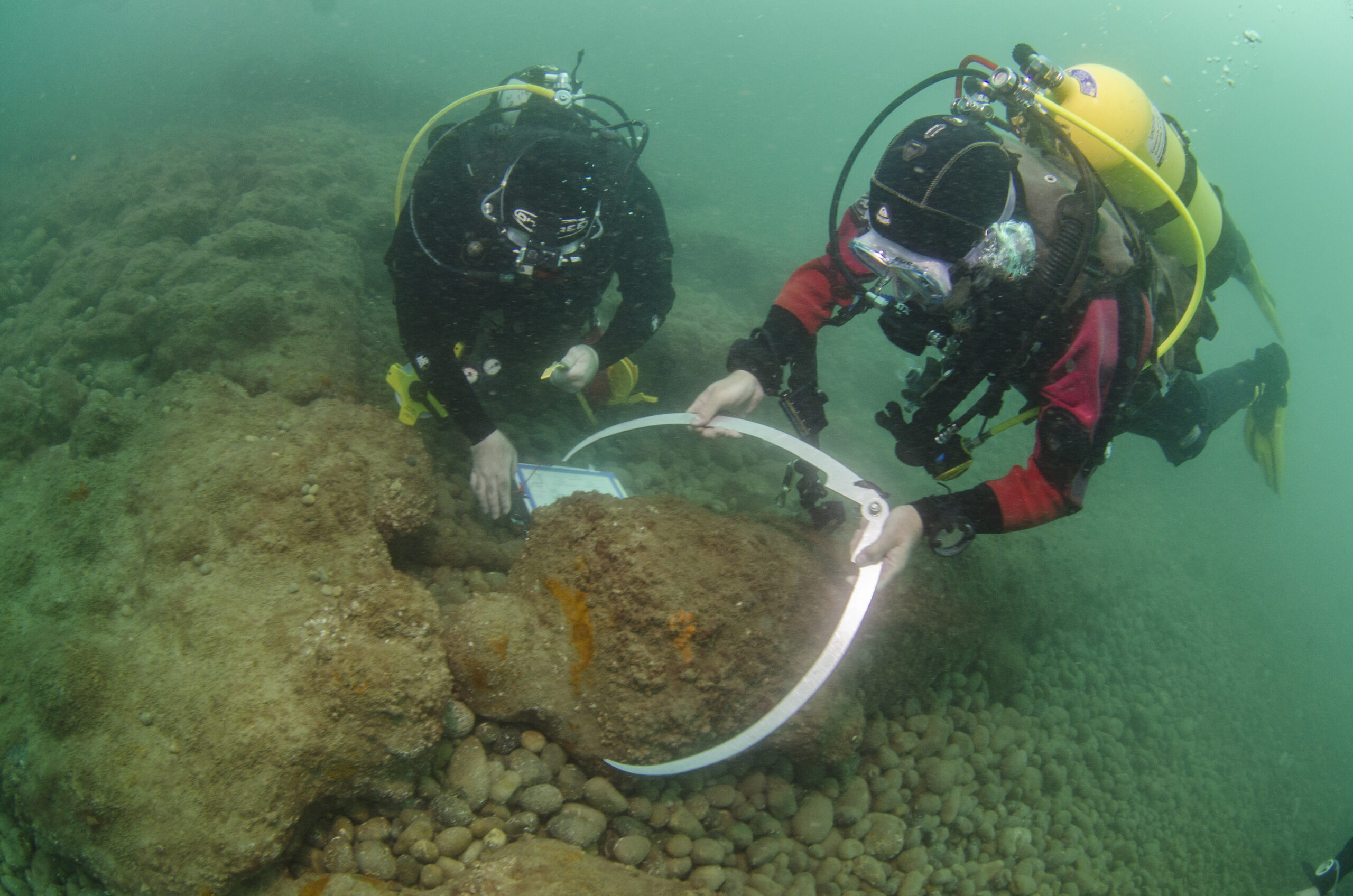
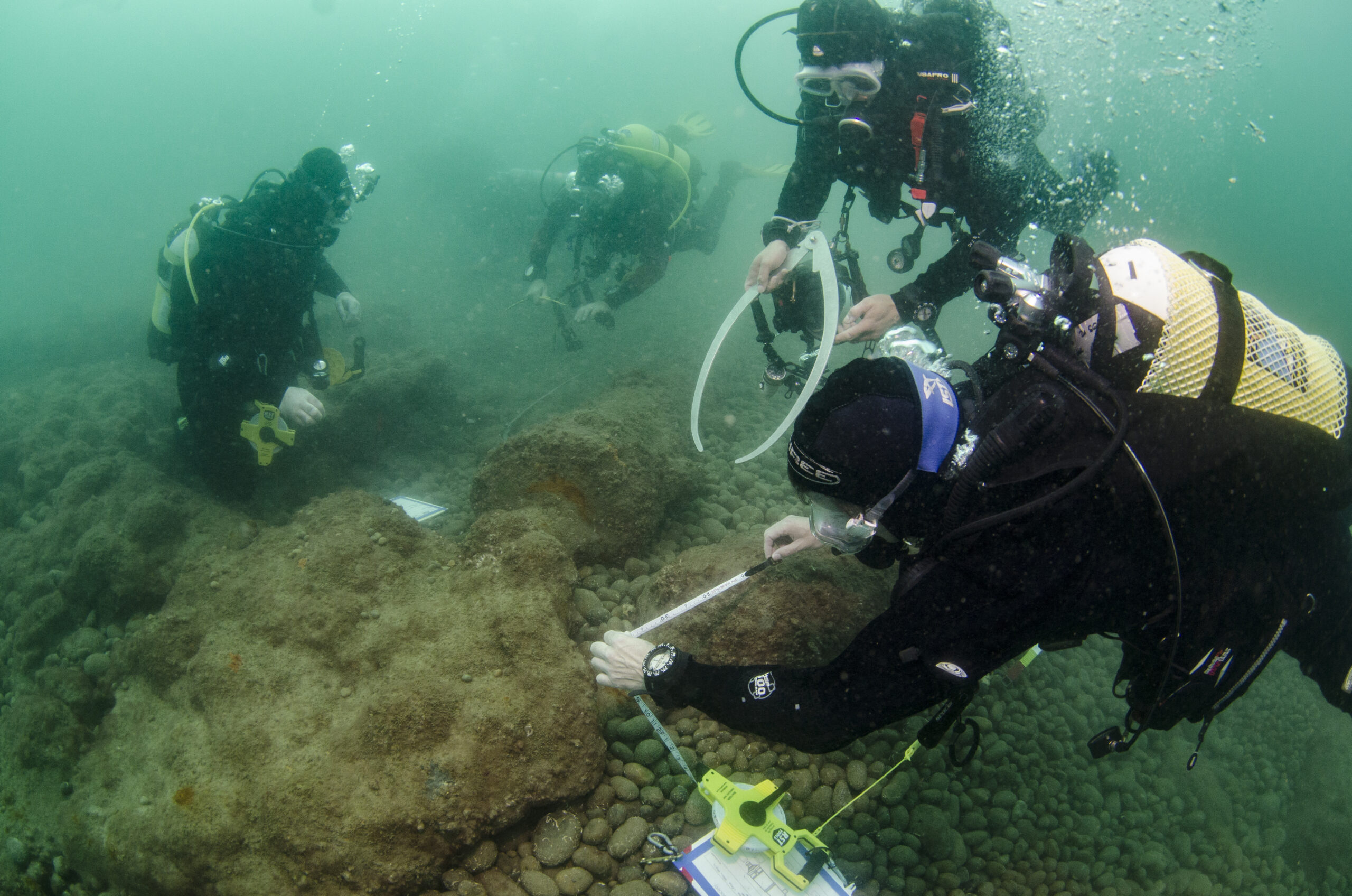
Between 2019 – 2021, we have worked in collaboration with the Nautical Archaeology Society and local divers with funding from Historic England to undertake work on these sites.
Fieldwork and modelling of the Inshore Site in 2019 showed that the material was relatively stable and had good sediment cover. Given the dynamic nature of this shoreline, ongoing monitoring will be vital to understand long-term stability of this assemblage.
Diver based site investigation by MAT divers identified threats to the Offshore Site, with one of the largest guns having been displaced almost 10m, and interference with other guns also recorded. Despite challenging visibility, the location of an eight gun was also recorded during the photogrammetry survey in this year.
In addition to the development of a conservation statement and management plan for the sites, as well as public talks, mobile exhibitions and an exciting interactive tour, this project has helped to develop a team of local divers and provide them with onsite training in traditional and 3D recording techniques. The MAT and the NAS will continue to support this enthusiastic team as they take on the challenges of becoming long-term custodians of these important underwater cultural heritage sites.
Read more at: https://historicengland.org.uk/listing/the-list/list-entry/1433972
NAS: https://www.nauticalarchaeologysociety.org/chesil-beach-protected-wrecks
Chesil Beach and Stennis Ledges MCA: https://www.gov.uk/government/publications/marine-conservation-zone-2013-designation-chesil-beach-and-stennis-ledges
Applying for a license: https://historicengland.org.uk/advice/planning/consents/protected-wreck-sites/applying-for-licensing/