NGO Projects
Master record (return to list)
| ID | Logo | Organisation Name | Organisation Status | Nominating Org | Main Contact | Website URL | Geographic Coverage | Education Expertise | Other Expertise | Organisation Profile | Record Created | Record Creator | |
|---|---|---|---|---|---|---|---|---|---|---|---|---|---|
| 7 | Nautical Archaeology Society | UNESCO Accredited | NULL | Peta Knott | https://www.nauticalarchaeologysociety.org/ | education@nauticalarchaeologysociety.org | International | Academic,Outreach,school children and student placements,Policy,Professional,Public | Advocacy,Fieldwork capabilities,Outreach,Research,Training/capacity building,Volunteer co-ordination | Our mission is to research, record and protect our threatened underwater an... more | 2021-06-04 14:54:41 | Peta Knott |
| ID | 11 |
|---|---|
| Project Main Image | .png) |
| Org ID | 7 |
| Project Name | Discover Maritime Archaeology eLearning course |
| Project URL | https://moodle.nauticalarchaeologysociety.org/ |
| Project Description | The Discover Maritime Archaeology eLearning course is the entry level to the Nautical Archaeology Society's Education Programme. No prior knowledge or training is required to complete this course. This online course allows people to learn the basic theory of maritime archaeology at their own pace. I... more |
| Latitude (WGS84) | 50.7888 |
| Longitude (WGS84) | -1.0319 |
| Record Created | 2021-12-14 12:04:16 |
| Record Creator | Peta Knott |
| Project Location | 254 |
| Project Sdgs | 0 |
| ID | 10 |
|---|---|
| Project Main Image | 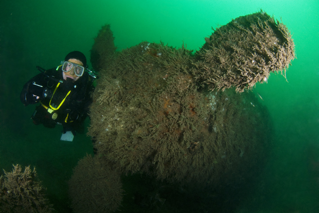 |
| Org ID | 7 |
| Project Name | Protected Wreck Days |
| Project URL | https://www.nauticalarchaeologysociety.org/protected-wreck-days |
| Project Description | One of the major aims of the Nautical Archaeology Society (NAS) is to provide divers access to Protected Wrecks and by doing so, fostering a sense of custodianship of underwater cultural heritage. Several times each year, the NAS runs Protected Wreck Days allowing qualified divers to have an extraor... more |
| Latitude (WGS84) | 50.7214 |
| Longitude (WGS84) | -1.0884 |
| Record Created | 2021-12-14 11:38:45 |
| Record Creator | Peta Knott |
| Project Location | 254 |
| Project Sdgs | 0 |
| ID | 14 |
|---|---|
| Project Main Image | 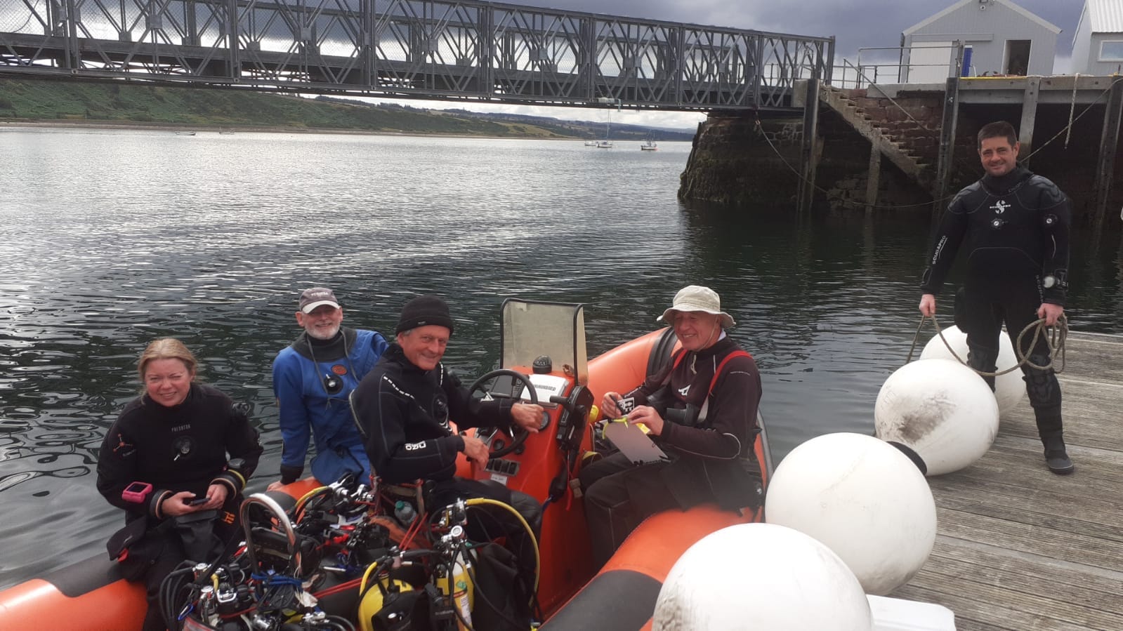 |
| Org ID | 7 |
| Project Name | HMS Natal |
| Project URL | https://www.nauticalarchaeologysociety.org/mod-wreck-assessments |
| Project Description | The Ministry of Defence (MOD) has multiple historic shipwrecks in UK waters and little is known about the condition of many of these wreck sites. Consequently, the Nautical Archaeology Society (NAS) carried out a programme of non-intrusive condition assessments using the HMS Natal in the Cromarty Fi... more |
| Latitude (WGS84) | 57.6959 |
| Longitude (WGS84) | -4.0891 |
| Record Created | 2023-08-24 14:29:44 |
| Record Creator | Peta Knott |
| Project Location | 254 |
| Project Sdgs | 0 |
| ID | 15 |
|---|---|
| Project Main Image |  |
| Org ID | 7 |
| Project Name | Identifying Explosive and Environmental Hazards on Wrecks |
| Project URL | https://moodle.nauticalarchaeologysociety.org/ |
| Project Description | Learn how to safely dive on military wrecks and help to identify environmental and explosive hazards on wrecks. This course is a pre-requisite for NAS MOD diving projects. |
| Latitude (WGS84) | 50.7888 |
| Longitude (WGS84) | -1.0319 |
| Record Created | 2023-08-24 14:38:24 |
| Record Creator | Peta Knott |
| Project Location | 254 |
| Project Sdgs | 0 |
| ID | 16 |
|---|---|
| Project Main Image |  |
| Org ID | 7 |
| Project Name | International Training Partner Scheme |
| Project URL | https://www.nauticalarchaeologysociety.org/Pages/Category/international-system |
| Project Description | We support organisations from around the world in teaching best practices in underwater cultural heritage through our International Training Partner Programme. These organisations have a licence to teach a local version of our accredited training programme which has a core module on UCH legislation ... more |
| Latitude (WGS84) | 50.7888 |
| Longitude (WGS84) | -1.0319 |
| Record Created | 2023-08-24 14:51:10 |
| Record Creator | Peta Knott |
| Project Location | 254 |
| Project Sdgs | 0 |