Master record (return to list)

ID Logo Organisation Name Organisation Status Nominating Org Main Contact Website URL Email Geographic Coverage Education Expertise Other Expertise Organisation Profile Record Created Record Creator
12 CINDAQ - Centro Investigador del Sistema Acuifero de Quintana Roo A.C. UNESCO Accredited NULL Sam Meacham https://www.cindaq.org info@cindaq.org Regional,National,Local,International Academic,Education,Professional,Public Outreach,Reasearch,Public Training/capacity building,Documentation,Volunteer co-ordination,Fieldwork capabilities,Mapping,Research,Photogrammetry,Cave diving,Exploration,Geographic Information Systems CINDAQ is an organization dedicated to the exploration and documentation of... more
CINDAQ is an organization dedicated to the exploration and documentation of the Yucatan aquifer and the archaeological objects within, funded by conscious individuals and responsible organizations desirous of the collaborative development of relevant knowledge and usable content that will enhance our understanding of some of the world’s most extensive underground river systems, and in so doing, deepen our commitment to the conservation of this unique, life-sustaining resource, as well as the biological, historical and cultural objects it contains.
2021-07-06 20:17:48 cindaq
ID 12
Project Main Image
Org ID 12
Project Name Sagitario La Mina
Project URL https://www.cindaq.org/copy-of-sagitario-la-mina
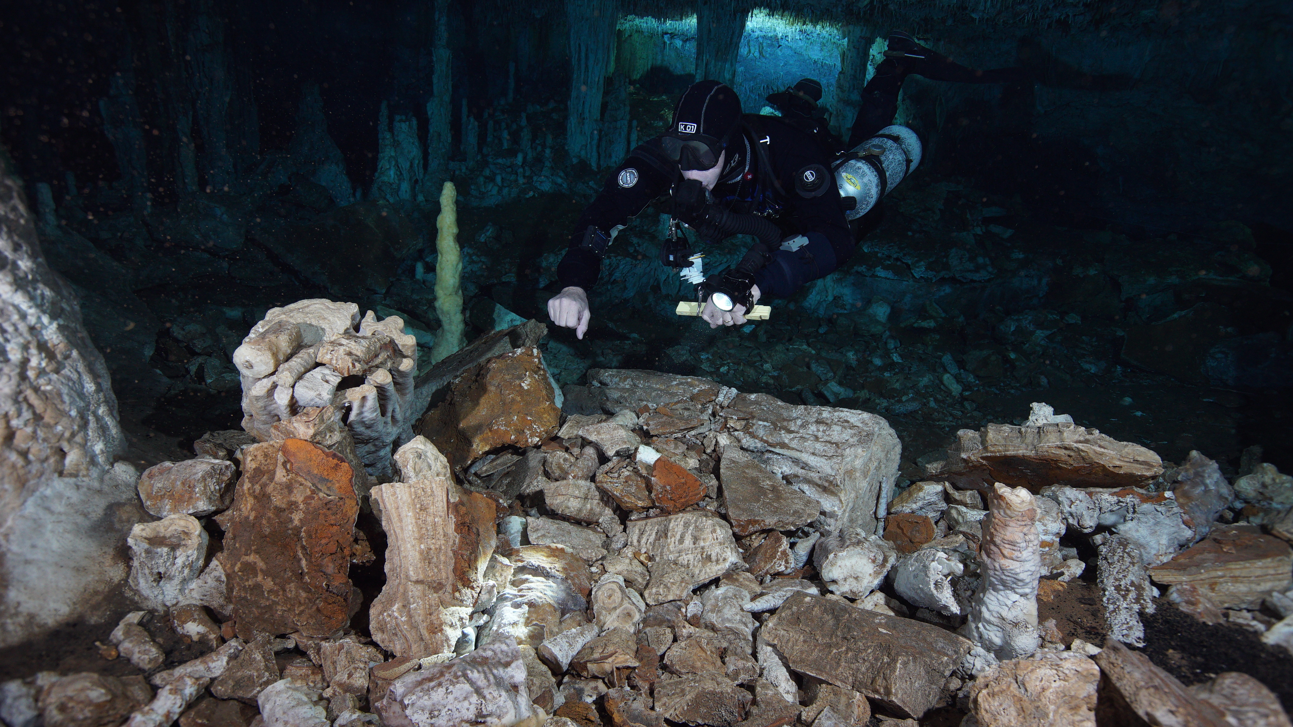
Project Description In 2017, CINDAQ's dive team found evidence of ancient mining activity while exploring and mapping new tunnels of an underwater cave near Akumal, Quintana Roo, Mexico. The Maya are known to have actively mined pigment and other minerals from the caves of the Yucatan Peninsula, but the ancient mine... more
In 2017, CINDAQ's dive team found evidence of ancient mining activity while exploring and mapping new tunnels of an underwater cave near Akumal, Quintana Roo, Mexico. The Maya are known to have actively mined pigment and other minerals from the caves of the Yucatan Peninsula, but the ancient mines discovered by the CINDAQ team are now submerged, indicating that such mineral exploitation occurred thousands of years ago. At the end of the last Ice Age, intrepid miners ventured deep into these tunnels with torches in hand. The navigational markers, mining debris, fire pits and excavation pits they left behind are now entirely underwater. In coordination with INAH-SAS, CINDAQ's team performed more than 100 dives, totaling nearly 600 diver hours underwater to create a detailed map of the site. An additional 100 diver hours were dedicated to acquiring the nearly 18,000 images used for the 3D photogrammetric models, which are enabling researchers to “virtually” access and study this remote subterranean mining complex. The results were published in 2020 in Science Advances.
Latitude (WGS84) 20.6000
Longitude (WGS84) -87.4000
Record Created 2022-07-28 19:54:41
Record Creator cindaq
Project Location 163
Project Sdgs NULL